The post Hurricane Polo Strengthens Offshore of Mexico as Coastal Communities Brace for Rain, Flooding and Dangerous Surf first appeared on Crafting Your Home.
Hurricane Polo has strengthened into a Category 1 hurricane over the eastern Pacific, bringing increased attention to Mexico’s southwestern coastline as forecasters warn of possible heavy rainfall, flooding risks, dangerous surf and tropical-storm conditions in parts of the region.
The storm intensified rapidly on Monday, September 21, 2026, while remaining offshore south of Mexico’s Pacific coast. According to the National Hurricane Center (NHC), Polo reached hurricane strength with maximum sustained winds of 80 mph (130 km/h) and a central pressure of 977 millibars.
At the latest verified advisory, Hurricane Polo was located about 190 miles south-southwest of Zihuatanejo and approximately 270 miles south-southeast of Manzanillo. The storm was moving slowly eastward at around 5 mph, with forecasters expecting a turn toward the west-northwest or northwest later Tuesday.
Although Polo is currently a hurricane, it is not yet considered a major hurricane. The NHC forecast that the storm could strengthen into a major hurricane by Tuesday, with additional intensification possible through midweek.
Hurricane Polo intensifies quickly offshore
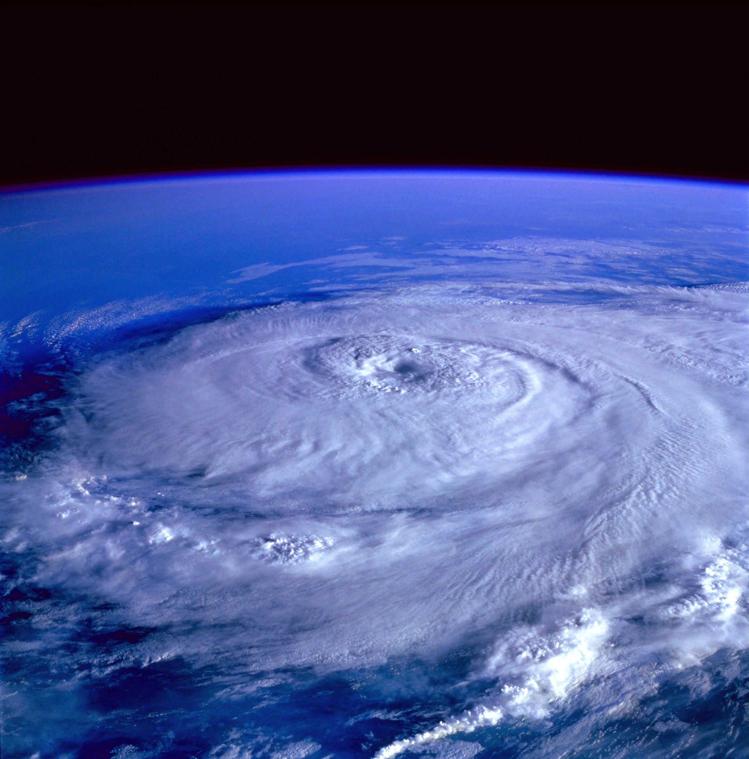
Polo’s rapid strengthening followed a period of favorable conditions for tropical cyclone development.
Earlier Monday morning, Polo was still a tropical storm with sustained winds of 65 mph. By midday, the system had strengthened into a Category 1 hurricane with winds reaching 80 mph.
Forecasters attributed the storm’s strengthening potential to several environmental factors, including very warm ocean temperatures, high atmospheric moisture, light wind shear and an increasingly organized storm structure. These conditions can allow tropical systems to develop stronger circulation and intensify more quickly.
The NHC’s forecast discussion indicated that rapid intensification remained possible, but forecasts are not guarantees. Storm intensity and track can change as hurricanes interact with changing atmospheric and ocean conditions.
Mexico’s Pacific coast watches the storm closely
While Hurricane Polo’s center is expected to remain offshore, forecasters warned that coastal areas could still experience significant weather impacts.
The NHC issued a Tropical Storm Watch from Tecpan de Galeana in Guerrero to Punta San Telmo in Michoacán. A watch means tropical-storm conditions are possible, generally within 48 hours, but it is not the same as a warning.
The agency said the watch could be expanded westward as the storm forecast developed.
The distinction between a watch and a warning is important. A Tropical Storm Watch means conditions are possible, while a Tropical Storm Warning means those conditions are expected within the designated area.
At the time of the latest advisory, no hurricane warning had been issued for Mexico’s Pacific coast.
Heavy rain and flooding risks increase
Even without a direct landfall, Hurricane Polo could bring dangerous weather conditions to parts of southwestern Mexico.
The NHC forecast that coastal Guerrero and Michoacán could receive between 4 and 8 inches of rainfall, with isolated totals reaching up to 12 inches. Forecasters warned that this rainfall could produce life-threatening flooding and mudslides, especially in steep terrain.
Coastal areas of Oaxaca, Colima and Jalisco were also expected to receive rainfall, with forecasts calling for around 3 to 6 inches through Thursday.
The storm was also expected to generate dangerous ocean conditions. The NHC warned that swells could begin affecting southwestern Mexico from Tuesday, creating life-threatening surf and rip-current conditions.
Officials have emphasized that heavy rainfall and coastal hazards can occur even when a hurricane’s center remains offshore.
What travelers in Mexico need to know
For visitors planning trips to Mexico’s Pacific coast, the biggest concerns are currently related to weather conditions rather than widespread travel shutdowns.
At the time of the latest verified information, there were no confirmed reports of broad flight cancellations, airport closures, hotel shutdowns, cruise cancellations or tourist evacuation orders linked to Hurricane Polo.
However, travelers in areas potentially affected by the storm should continue monitoring updates from airlines, hotels, local authorities, ports and weather agencies.
Visitors planning beach activities, boat trips or other marine excursions should pay close attention to local conditions because dangerous surf and rip currents may develop even if the storm remains offshore.
Travelers heading to or already staying in coastal Guerrero, Michoacán, Colima, Jalisco or Oaxaca should not assume that normal conditions will continue without checking updated forecasts.
How Polo could affect popular destinations
Several well-known Pacific coast destinations are being watched because of their proximity to the storm.
Zihuatanejo and the Ixtapa area were among the locations specifically referenced by the NHC because of Polo’s position offshore. At the latest advisory, the storm was about 190 miles south-southwest of Zihuatanejo. Forecasters highlighted possible rainfall, flooding and surf concerns across Guerrero.
Manzanillo was located farther west, with Polo about 270 miles south-southeast of the city. While the advisory reviewed did not list a Tropical Storm Watch for Manzanillo, forecasters included Colima among areas that could experience rainfall and surf impacts.
Other destinations, including Acapulco and Puerto Vallarta, should be monitored through local forecasts rather than assumed to be directly affected, as the exact impact area depends on the storm’s future track and intensity.
No confirmed landfall forecast
One of the most important points for residents and travelers is that Hurricane Polo has not been forecast to make landfall at the time of the latest advisory.
The NHC forecast the storm’s core to remain offshore while moving near Mexico’s southwestern coastline over the coming days. However, the agency warned that the exact location and strength of impacts remained uncertain.
An offshore storm can still create dangerous conditions through heavy rain, coastal flooding, strong surf and rip currents. Officials have advised residents and visitors to continue monitoring updated forecasts as the storm evolves.
What happens next
The forecast timeline suggests that Polo will continue changing over the next several days.
On Monday, the storm strengthened into a Category 1 hurricane while moving slowly offshore. By Tuesday, forecasters expected Polo to turn toward the west-northwest or northwest and potentially strengthen into a major hurricane.
By Tuesday night or early Wednesday, tropical-storm conditions were possible within the current watch area. Through Wednesday and Thursday, rainfall and surf hazards remained a concern along portions of Mexico’s Pacific coast.
However, forecasts remain subject to change, and officials have warned against assuming a specific outcome before newer advisories are issued.
Travelers should monitor updates, not panic
Hurricane Polo is a developing weather system that requires attention, but current information does not indicate a widespread tourism shutdown across Mexico’s Pacific coast.
The most important steps for travelers are simple: check the latest weather advisories, confirm flight and hotel information directly with providers, follow local instructions and avoid dangerous coastal conditions.
As Hurricane Polo continues moving offshore, officials will be watching whether the storm strengthens further, changes direction or brings greater impacts to coastal communities.
For now, forecasters’ message is clear: the storm is serious, but the situation remains a developing forecast rather than a confirmed disaster event.
Other Posts You Might Like
If you like what you just read, then subscribe to our newsletter and follow us on social media.